Flood Risk Assessment Brighton
Professional flood risk assessments in Brighton and Hove. Groundwater flooding, surface water drainage, chalk aquifer assessment, SuDS and LLFA consultation.
Brighton and Hove sits on the southern dip slope of the South Downs, where the chalk geology that defines the landscape also defines the city’s principal flood risk. Unlike most English cities where rivers dominate the flood risk picture, Brighton’s primary flood risk source is groundwater. The South Downs chalk aquifer underlies the entire city, and when prolonged rainfall recharges this aquifer, groundwater levels can rise dramatically, saturating the ground and causing water to emerge at the surface in dry valleys and low-lying areas. This mechanism makes Brighton’s flood risk fundamentally different from cities where surface water and fluvial flooding are the dominant concerns.
The city’s topography amplifies flood risk from all sources. The South Downs rise steeply to the north, and the urban area cascades down the dip slope towards the coast. This steep gradient means that surface water flows rapidly downhill during intense rainfall, collecting in valleys and low points before reaching the coast. When groundwater levels are already high, the capacity of the ground to absorb surface water is reduced, creating compound flood risk where groundwater emergence and surface water runoff interact.
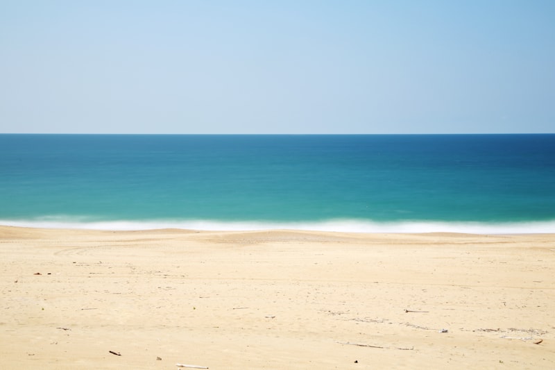
Brighton’s coastal location adds a further dimension. The English Channel seafront is exposed to wave overtopping during storm events, particularly when high tides coincide with onshore gales. Coastal flood risk requires assessment for development along the seafront, including consideration of sea level rise over the development’s design life. The combination of groundwater, surface water and coastal flood risk makes Brighton’s flood risk assessment requirements genuinely distinctive.
Flood Risk Sources in Brighton
Groundwater Flooding
Groundwater flooding from the South Downs chalk aquifer is Brighton’s defining flood risk. The chalk is a major aquifer with high storage capacity and moderate permeability. During prolonged wet periods, rainfall percolating through the chalk causes the water table to rise. When the water table reaches the surface level in valleys and low-lying areas, groundwater emerges, flooding properties and roads.
The Patcham area, located in a dry valley at the foot of the Downs, is particularly susceptible. The Wellesbourne, a winterbourne stream that flows through Patcham when groundwater levels are high, has caused repeated flooding. Other dry valleys across the city, including those through Rottingdean, Saltdean and Woodingdean, contain winterbournes that activate during high groundwater conditions.
Groundwater flood risk is difficult to predict precisely because it depends on cumulative rainfall over weeks or months rather than single storm events. The response time of the chalk aquifer means that groundwater levels can continue to rise for weeks after rainfall has ceased. This creates a flood risk profile that is fundamentally different from the rapid-onset fluvial and surface water flooding experienced in other cities.
Surface Water Flooding
Brighton’s steep topography and extensive impermeable urban coverage create significant surface water flood risk. Rainfall on the Downs and upper slopes of the city flows rapidly downhill, collecting in valleys and low points where drainage capacity is limited. The city’s drainage network includes both separate surface water systems and combined sewers, and intense rainfall can overwhelm both types of infrastructure.
Surface water flood risk is exacerbated when groundwater levels are high. Saturated ground cannot absorb additional rainfall, and infiltration-based drainage systems become ineffective when the water table is close to the surface. This interaction between groundwater and surface water flood risk is a critical consideration for development in Brighton.
Fluvial Flooding
Brighton does not have major rivers, but several smaller watercourses and winterbournes present fluvial flood risk when active. The Wellesbourne in Patcham is the most significant, flowing as a surface watercourse when the chalk water table is high. Other winterbourne streams in the dry valleys around Rottingdean and along the coast can also become active during wet periods. These watercourses are typically small but can carry significant flows when the chalk is saturated and additional rainfall occurs.
Tidal and Coastal Flooding
Brighton’s seafront is exposed to coastal flood risk from wave overtopping and storm surge in the English Channel. The coastal defences, including sea walls, groynes and shingle beaches, provide protection under normal conditions, but extreme events can cause overtopping. Tidal flood risk affects low-lying areas behind the seafront, and the risk will increase as sea levels rise under climate change. Flood risk assessments for seafront development must incorporate sea level rise projections over the full design life.
Planning Requirements
Brighton & Hove City Council’s planning framework for flood risk is governed by the NPPF and supported by the council’s Local Plan policies and Strategic Flood Risk Assessment. Brighton’s SFRA provides particularly detailed mapping of groundwater flood risk, reflecting the importance of this flood source in the area.
The Sequential Test must be applied to direct development to areas of lowest flood risk. Given the widespread nature of groundwater flood risk across Brighton, the Sequential Test must consider all flood sources, not just the fluvial-focused Flood Zone mapping. The Exception Test applies where development in higher-risk areas is necessary.
Brighton & Hove City Council, as a unitary authority LLFA, requires major developments to submit surface water drainage strategies. The council’s strong preference is for infiltration-based drainage where ground conditions allow, reflecting the chalk geology’s high permeability. However, infiltration must be demonstrated through BRE365 testing, and minimum clearance above the highest recorded groundwater level is required to prevent drainage systems becoming ineffective during high groundwater conditions.
The Environment Agency is consulted on groundwater flood risk matters, Flood Zone 2 and 3 sites, and coastal flood risk. For developments proposing significant infiltration, the EA may require assessment of the impact on groundwater levels and flow paths.
Southern Water is the local water and sewerage company. Pre-development enquiries are required for sewer connections, and Southern Water’s capacity constraints — a significant issue in parts of Brighton — can influence drainage strategy design.
Key Flood History
Winter 2000-2001 Groundwater Floods
The winter of 2000-2001 brought exceptionally prolonged rainfall to southern England, causing the South Downs chalk aquifer to reach record high levels. Groundwater flooding severely affected Patcham, where the Wellesbourne flowed continuously for months, flooding properties and roads. Areas in Rottingdean, Woodingdean and elsewhere across the city also experienced groundwater emergence. The event lasted for several months as the chalk aquifer slowly drained, causing sustained disruption and property damage. It remains the primary reference event for groundwater flood risk assessment in Brighton.
Winter 2013-2014
The exceptionally wet winter of 2013-2014 caused groundwater levels in the chalk to rise significantly, though not to the extremes of 2000-2001. Patcham again experienced groundwater emergence, and the Wellesbourne flowed for an extended period. The event reinforced the ongoing nature of groundwater flood risk in Brighton and the need for development to account for high groundwater conditions.
July 2014 Surface Water Flooding
In July 2014, intense summer rainfall caused significant surface water flooding across Brighton. The steep topography concentrated runoff in valleys and low-lying areas, overwhelming drainage and flooding properties. The event demonstrated that surface water flood risk is a significant concern alongside groundwater, particularly during short-duration, high-intensity storms.
November 1984 Coastal Flooding
Storm surges in November 1984 caused wave overtopping along sections of the Brighton seafront. Low-lying areas behind the coastal defences were flooded, and the event contributed to subsequent investment in coastal defence improvements. The event is relevant to coastal flood risk assessment for seafront development.
Our Services in Brighton
Flood Risk Assessments
Aegaea delivers flood risk assessments that address Brighton’s distinctive flood risk profile. Our assessments cover groundwater, surface water, fluvial and coastal flood risk in accordance with Brighton & Hove City Council’s SFRA and planning policy requirements. We prepare Sequential and Exception Test evidence, site-specific FRAs with groundwater flood risk assessment, and drainage strategies tailored to Brighton’s chalk geology.
Infiltration Testing
Brighton’s chalk geology makes infiltration testing a critical component of drainage design. Aegaea undertakes BRE365 soakaway testing to determine site-specific infiltration rates, assess the feasibility of infiltration-based SuDS and design soakaway systems. We ensure testing accounts for seasonal groundwater variation and provides the data needed for robust drainage design.
Drainage Design and SuDS
Brighton’s chalk geology offers excellent infiltration potential, and our drainage designs maximise this where ground conditions allow. We design soakaways, infiltration trenches, permeable paving and other infiltration-based SuDS while accounting for groundwater levels, contamination constraints and the limitations imposed by high water table conditions. Where infiltration is not feasible, we design attenuation-based systems with controlled discharge.
Groundwater Assessment
Aegaea provides detailed groundwater flood risk assessment for Brighton development sites. This includes analysis of historical groundwater level records, assessment of the site’s vulnerability to groundwater emergence, and evaluation of the implications for foundation design, basement construction and drainage system performance during high groundwater conditions.
Why Choose Aegaea for Your Brighton Project
Brighton’s flood risk is fundamentally different from most English cities, and it requires consultants who understand the chalk aquifer, groundwater dynamics and the interaction between groundwater, surface water and coastal flood risk. Aegaea brings this specialist knowledge to every Brighton project.
Our experience in Brighton includes residential development on the Downs dip slope, seafront regeneration, city centre commercial schemes and developments in the dry valleys that are susceptible to groundwater flooding. We understand Brighton & Hove City Council’s approach to flood risk, the council’s emphasis on infiltration-based drainage, and the specific requirements for groundwater flood risk assessment that apply in this unique geological setting.
For developers and planning consultants working in Brighton, Aegaea provides the specialist flood risk and drainage expertise that addresses the city’s distinctive challenges. We deliver assessments that satisfy regulatory requirements while enabling development to proceed confidently on sites where groundwater, topography and coastal exposure create a complex flood risk environment.
Frequently Asked Questions: Brighton
Do I need a flood risk assessment in Brighton?
An FRA is required for sites in Flood Zone 2 or 3, for major developments (10+ dwellings or 1,000m²+), and for sites over 1 hectare in Flood Zone 1. Brighton & Hove City Council also requires FRAs for developments in areas of groundwater flood risk identified in the SFRA, which affects large parts of the city.
What is groundwater flooding and why is it a risk in Brighton?
Groundwater flooding occurs when the water table in the chalk aquifer rises to or above ground level, saturating the soil and causing water to emerge at the surface. Brighton sits on the South Downs chalk, and prolonged wet weather causes groundwater levels to rise, sometimes dramatically. The Patcham area is particularly susceptible, as are dry valleys across the city that become active watercourses during high groundwater conditions.
What are winterbournes in Brighton?
Winterbournes are watercourses that only flow when the chalk aquifer groundwater table rises above the level of the valley floor, typically following prolonged wet weather in autumn and winter. Several dry valleys across Brighton contain winterbournes that can become active watercourses and cause flooding. The Wellesbourne in Patcham is the most notable example.
Can I use infiltration drainage in Brighton?
Infiltration is often feasible in Brighton due to the underlying chalk geology, which has high permeability. However, infiltration must be assessed through BRE365 soakaway testing, and there are constraints including minimum clearance above the groundwater table, proximity to the chalk cliff edge, contaminated land considerations, and areas where the chalk is overlain by less permeable deposits.
What drainage rates does Brighton & Hove require?
Brighton & Hove City Council requires developments to achieve greenfield runoff rates where feasible. Given the chalk geology, infiltration is the preferred disposal method where ground conditions are suitable. Where infiltration is not feasible, restricted discharge to surface water sewer or combined sewer is required with appropriate attenuation.
How does the South Downs National Park affect development in Brighton?
Parts of the Brighton & Hove district fall within the South Downs National Park, where the National Park Authority is the planning authority. Flood risk and drainage requirements within the National Park may differ from those in the city itself, and environmental sensitivities including chalk stream ecology influence SuDS design and groundwater management.
What happened during the 2000-2001 groundwater floods in Brighton?
The winter of 2000-2001 brought exceptionally prolonged rainfall that caused the chalk aquifer to reach record high levels. Groundwater flooding affected Patcham, Rottingdean and other areas across Brighton, with water emerging from the ground surface and flowing down dry valleys. Properties were flooded and roads became impassable. The event remains the benchmark for groundwater flood risk assessment in the area.
Does Brighton have coastal flood risk?
Yes. Brighton's seafront is exposed to coastal flood risk from wave overtopping and tidal surge in the English Channel. Development along the seafront must assess coastal flood risk including the effects of sea level rise over the development's design life. The coastal defences are managed by Brighton & Hove City Council and the Environment Agency.