Mixed-Use FRA in Edinburgh
Detailed flood risk assessment and SEPA liaison for a mixed-use development on the Water of Leith floodplain, delivering planning approval within 8 weeks.

Project challenges
The site sat within SEPA's medium probability flood extent (1 in 200 year) for the Water of Leith, placing it in an area where residential development required careful justification under Scottish Planning Policy. The existing SEPA flood mapping, based on broad-scale modelling from 2015, suggested flood depths of up to 0.8 metres across the eastern portion of the site during the design event.
The client's proposed scheme included ground-floor commercial units with residential apartments above — a mixed vulnerability that complicated the flood risk assessment. SEPA's pre-application response indicated that they would require detailed hydraulic modelling to demonstrate that the development could be made safe, and that the broad-scale mapping alone would not be sufficient to support the application. The site's position downstream of a historic weir structure added further complexity, as the weir's backwater effect was not well represented in the existing modelling.
How we solved it
We commissioned a detailed 2D TUFLOW model of a 2.8-kilometre reach of the Water of Leith, extending from upstream of the weir to a suitable downstream boundary. The model was built using 1-metre resolution LiDAR data, supplemented by topographic survey of the weir crest, bridge soffits, and channel cross-sections.
The model was calibrated against the December 2015 flood event using recorded water levels at two gauging stations within the model reach. Calibration performance was excellent, with peak water levels within 50mm of observed levels at both stations. Design scenarios were run for the 1 in 200 year event with climate change allowances applied in accordance with SEPA's current guidance (a 33% increase in peak flow for the 2080s epoch).
The modelling demonstrated that the eastern portion of the site was subject to shallow, low-velocity flooding in the design event, but that the western two-thirds of the site remained dry. We worked with the design team to relocate all residential entrances and habitable ground-floor space to the western portion of the site, positioning commercial units in the flood-affected area with finished floor levels set 600mm above the modelled 1 in 200 year plus climate change flood level.
Results delivered
Planning was granted with conditions within 8 weeks of submission. SEPA withdrew their initial holding objection after reviewing the modelling results and confirming that the calibrated model represented a significant improvement over their broad-scale mapping.
The modelling evidence also supported a reduction in the mapped flood extent for the site, with SEPA acknowledging that their published mapping overestimated the risk in this location due to the limitations of the broad-scale approach. The client avoided the need for a site-wide flood risk avoidance assessment by demonstrating through modelling that vulnerable uses could be safely accommodated within the site boundary.
The project demonstrated the value of early investment in detailed modelling — the cost of the TUFLOW model was recovered many times over through the avoidance of a prolonged planning process and the optimisation of the developable area.
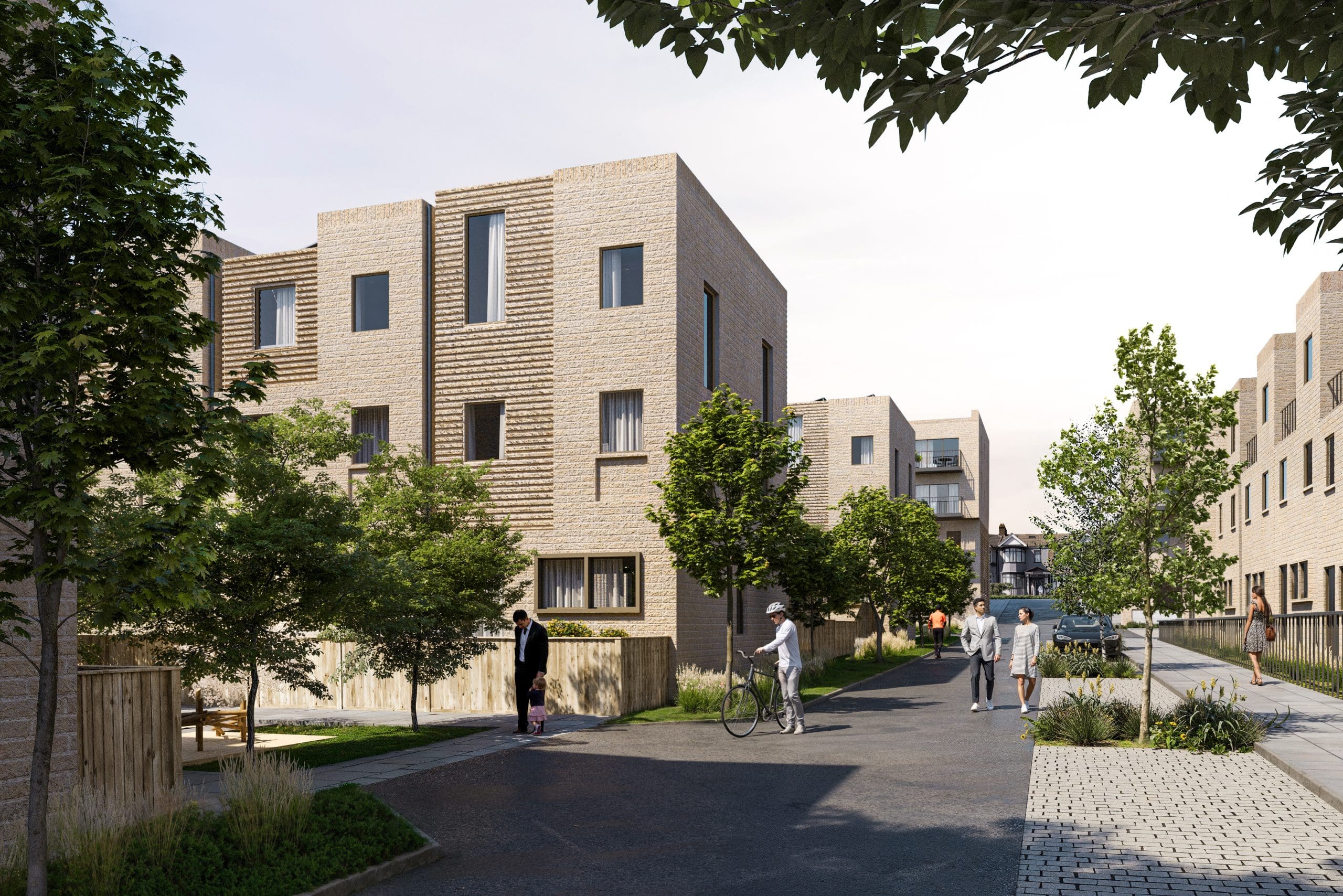
Project Overview
This mixed-use development in Edinburgh presented a challenge that is common in Scottish cities: a commercially attractive site in a riverside location that falls within SEPA’s medium probability flood extent. The client had secured the site on the basis of its development potential but needed to demonstrate through robust flood risk evidence that the scheme could be delivered safely and in compliance with Scottish Planning Policy.
The Modelling Approach
Our approach centred on replacing SEPA’s broad-scale mapping with a calibrated, site-specific TUFLOW model. The model covered a 2.8-kilometre reach of the Water of Leith, extending far enough upstream and downstream to avoid boundary effects and to capture the hydraulic influence of the historic weir structure approximately 400 metres upstream of the site.
The model was built on a 2-metre grid resolution, providing sufficient detail to resolve the key features influencing flood risk — including the weir, two road bridges, and the channel walls that constrain the river through the urban reach. We used the most recent Environment Agency 1-metre LiDAR dataset (available through the Scottish Remote Sensing Portal) as the primary terrain input, supplemented by a commissioned topographic survey of in-channel features that LiDAR cannot capture.
Calibration was performed against the December 2015 flood event, which was the most significant recorded event on this reach within the past 20 years. Two gauging stations within the model reach provided observed water level data for comparison. The calibrated model reproduced peak levels within 50mm at both stations, giving strong confidence in the model’s ability to predict design event conditions.
Design Integration
The modelling results provided a clear picture of the flood risk across the site: the eastern third was subject to shallow flooding (100-300mm depth, low velocity) during the 1 in 200 year plus climate change event, while the western two-thirds remained dry.
Working with the project architect, we developed a layout that responded directly to this constraint. All residential entrances, ground-floor habitable space, and car parking access were located in the flood-free western zone. The eastern zone was allocated to commercial uses (a ground-floor retail unit and a cafe) with finished floor levels raised 600mm above the design flood level through a raised ground-floor slab.
This design-led approach turned the flood risk constraint into a positive feature of the scheme — the raised commercial frontage created a distinctive architectural treatment along the river edge, and the separation between residential and commercial entrances improved the legibility of the development.
SEPA Engagement
Our early engagement with SEPA’s planning liaison team was instrumental in achieving a smooth approval process. We shared the modelling methodology and calibration results with SEPA before submitting the planning application, allowing them to review the technical approach and raise any concerns before the formal consultation period began.
SEPA’s initial holding objection was based on the broad-scale mapping, which showed the entire site within the medium probability flood extent. Once they reviewed the calibrated model results, they confirmed that the site-specific modelling superseded their published mapping for the purposes of this application and withdrew the objection.
The formal SEPA consultation response was received within four weeks of the planning submission — significantly faster than the typical response time for applications involving detailed flood modelling. We attribute this to the pre-application engagement and the quality of the modelling evidence.
Key Outcomes
The project was delivered on programme and within budget, with planning approval secured within 8 weeks of submission. The detailed modelling investment — approximately £12,000 for the TUFLOW model, survey, and reporting — was modest relative to the overall development cost and was recovered through the time savings and design optimisation that the modelling enabled.
Related projects
Appeal Allowed for Retrospective Pond Development
Detailed hydraulic modelling demonstrated that an enlarged retrospective pond reduced flood risk, convincing the planning inspector to allow the appeal against an enforcement notice.
24MW BESS Planning Consent in Green Belt, Barrhead
Aegaea delivered flood risk and drainage evidence for a 24MW Battery Energy Storage System in the Green Belt adjacent to Dams to Darnley Country Park, achieving unanimous planning approval.
Capital Gate, Ilford
Navigated complex surface water risks and Sequential Test changes to secure planning approval for a residential redevelopment in a Critical Drainage Area.